NewsTracker Answers for week of June 12, 2023

Q: Thick, choking smoke darkened the skies and threatened the health of millions of people in the eastern United States last week as wildfires burning across Canada forced thousands to flee their homes. Hundreds of fires burned in several provinces, but Quebec was the hardest hit. Where is Quebec?

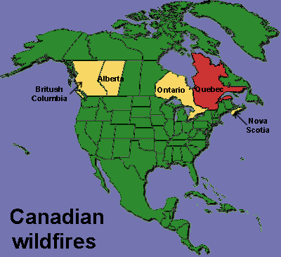
Circle the area on this map


Q: Fires have burned more than 2,800 square miles of Quebec, Canada’s largest province by area. Which Canadian province has the most people?

A. Alberta

B. British Columbia

C. Ontario

D. Quebec


C. Ontario has about 15 million residents, compared with about 8.7 million people in Quebec, the second most populous province. With a total area of 415,600 square miles, Ontario is the second-largest province behind Quebec’s 595,400 square miles.


Q: Northwestern states are also seeing smoke from fires in British Columbia and Alberta, the third- and fourth-largest provinces in both size and population. What percentage of Canadians live in these four largest provinces?

A. 56%

B. 66%

C. 76%

D. 86%


D. The vast majority of Canada's population is concentrated in areas close to its southern border with the United States, with 86 percent of the population living in the four largest provinces. The population drops dramatically in the northern parts of the country.


Q: Which of Canada's territories is the most sparsely populated?

A. Northwest

B. Nunavut

C. Yukon


B. The Nunavut territory is 725,000 square miles in the northernmost region of the country and has a population of about 40,000 people. That’s about 0.1 of a percent of Canada’s population.


Q: Nunavut has the lowest population density of all Canadian provinces and territories. Which region has most people per square kilometer?

A. Nova Scotia

B. Ontario

C. Prince Edward Island

D. Quebec


C. Prince Edward Island is Canada’s smallest province, with a total area of less than 2,200 square miles. But, it has an average of 27.2 people for every square kilometer of the island on Canada’s Atlantic Coast. That compares with only 0.02 people per square kilometer in the northern giant Nunavut.